Vercors May 12
May 12
First things on the agenda today were getting hold of a map and getting some breakfast. Both were easily done within a few blocks of the hotel -- the map is the Carte Departementale at 1:100,000 for Isere from the Institut Geographique National (www.ign.fr), which was available at a newstand in the train station. Breakfast was a "petit dejeuner traditionale" i.e. lots of bread & croissants, some mixed fruit and yogurt...normally I wouldn't go out for a continental breakfast but I think this was a perfect pre-ride meal since I could stuff myself and still had bread left over.
Then -- the ride. I decided to go for an "easy" ride the first day -- it would be my 3rd or 4th longest ride this year but it's easy compared to some others on the agenda, and the ratio of elevation gain to distance is actually less than most of the rides I've been doing in the East Bay. It's the first Vercors ride listed on the incredibly helpful anglophone site www.grenoblecycling.com. In brief it's the D106 from Grenoble to Lans-en-Vercors, the D531 to Villard-de-Lans and a bit further, back on the D106 north & the D106C to Autrans, back on the D106 to Lans-en-Vercors again, and down to Grenoble on the D531. Even though that's only two numbered roads, it actually makes a very nice 80+ km loop with no doubling-back.
Getting out of Grenoble wasn't too hard--I just followed the cycle lanes in the general direction I wanted to go and soon enough was on the climb up to St-Nizier. The climb was long -- an hour or so -- & unrelenting, (from 200m to 1100+ m elevation) but not too steep -- it was somewhere between Tunnel Road and Spruce/Grizzly Peak in Berkeley in gradient, both climbs I do pretty regularly, but longer (those gain about 520m, this was 900m +). I definitely felt fresher at the top than I had after climbing a comparable elevation to Mt. Tamalpais in Marin County a few weeks back. All along the road were trailheads leading off to hiking and mt. bike trails. Early on I passed a strong cyclist with a head of white hair, also a guy later on a mt. bike. More impressive was a guy I didn't pass -- he came out of the woods at a trailhead about 100m ahead of me, running, then turned off onto another trailhead as I was approaching him -- based on my speed, he was probably running a 6 minute mile, on a trail quite far from any obvious starting point.
Looking up from St-Nizier
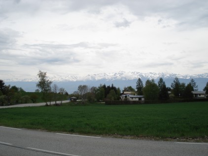
Looking east towards the Alps

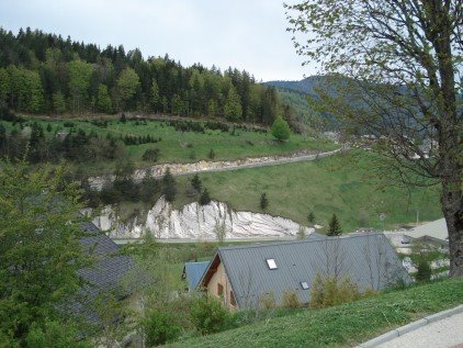
As you might guess from the elevation profile, the ride to Villard-de-Lans was pretty easy going. After the long climb, this stretch of the ride is an alpine valley, with lots of agricultural land & settlements. Right after I started descending at St-Nizier, I got passed by a red Corvette & thought that was an unusual vehicle to see in France. I looked up again and realized it had California plates.
All of the drivers I encountered were very polite -- not just the guys in the beat-up citroen with the mountain bikes on the back but truck drivers, motorcyclists, yuppies in town, etc. Once I got up onto the Vercors massif, I started seeing lots of cyclists, individuals and groups...maybe they knew something I didn't because all but two of them were going in the opposite direction from me.
In Lans-en-Vercors I stopped and made my 1st search for water--there were some public bathrooms but they didn't have a sink, so I ended up filling my bottle from the water in the toilet tank. Haha. Just to see if you were paying attention...actually I found a tap in Villard-de-Lans.
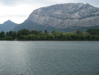
Looking S from Lans-en-Vercors with the east ridge of Vercors
Looking W from the same spot
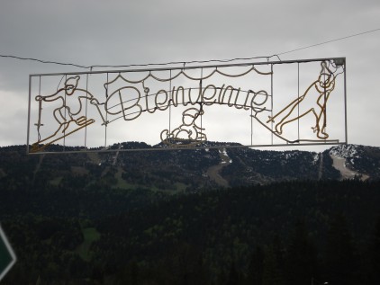
In every one of the villages in Vercors there were signs for "Ski de Fond" (x-c skiing) and one for a "Domaine Skiable" which sounded interesting...I looked in the back window of a bike/ski rental place in Lans-en-Vercors and there was a big rack of several generations of Salomon x-c ski boots hanging on the wall. My favorite ski sign was the (sadly unlit) neon nordic skier suspended in the air as part of the welcome sign to Villard-de-Lans. (5/13: I later found out that Autrans, at the northern end of the loop on the Vercors in this ride, was the base for the x-c ski races in the 1968 Winter Olympics).

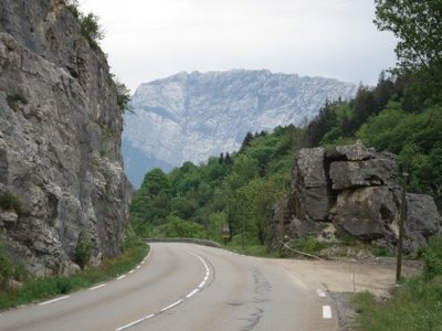
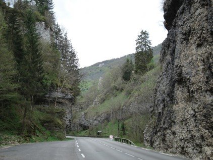
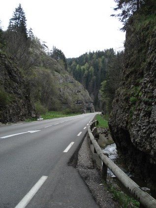
After leaving Villard-de-Lans I entered the first gorge--the road runs along a stream, with steep limestone walls on either side, before dropping into another alpine valley. I got a bit nervous here b/c it started to drizzle a bit--I had brought clothes for "partly cloudy" based on what I saw on weather underground earlier in the week--but it stopped soon enough. Overall the weather was perfect for riding--around 62-65 F I'd guess, without too much bright sunshine.
Up the gorge.

Down the gorge...
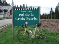
After Autrans began the second climb, which wasn't really much -- I had forgotten the elevation profile but this was only about 300m -- like the climb up Spruce to the intersection of Wildcat Canyon and Grizzly Peak in Berkeley that I often add on at the end of a ride for a little extra.
At the top...hardly worth a photo but I was stopped...
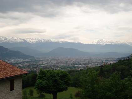
The descent on the D531 was great. The roads are wide and the curves are made for cars going 50 mph so there's plenty of room. Braking was hardly necessary & you could hold your speed through the turns. Even the few turns marked with warning signs were much wider than most of the turns on the climbs in the Bay Area. Great fun, & didn't feel dangerous at all. The descent started with another gorge then opened up with a panoramic view of the Chartreuse massif to the N and Grenoble to the E-SE with the Alps in the background.
At the bottom, I found my way through some residential and light industrial blocks on some bike trails to a trail that runs along the Isère River all the way back to Grenoble. A nice place for an easy spin for 20 minutes or so at the end of the ride.

Tomorrow...the Chartreuse.
First things on the agenda today were getting hold of a map and getting some breakfast. Both were easily done within a few blocks of the hotel -- the map is the Carte Departementale at 1:100,000 for Isere from the Institut Geographique National (www.ign.fr), which was available at a newstand in the train station. Breakfast was a "petit dejeuner traditionale" i.e. lots of bread & croissants, some mixed fruit and yogurt...normally I wouldn't go out for a continental breakfast but I think this was a perfect pre-ride meal since I could stuff myself and still had bread left over.
Then -- the ride. I decided to go for an "easy" ride the first day -- it would be my 3rd or 4th longest ride this year but it's easy compared to some others on the agenda, and the ratio of elevation gain to distance is actually less than most of the rides I've been doing in the East Bay. It's the first Vercors ride listed on the incredibly helpful anglophone site www.grenoblecycling.com. In brief it's the D106 from Grenoble to Lans-en-Vercors, the D531 to Villard-de-Lans and a bit further, back on the D106 north & the D106C to Autrans, back on the D106 to Lans-en-Vercors again, and down to Grenoble on the D531. Even though that's only two numbered roads, it actually makes a very nice 80+ km loop with no doubling-back.
Getting out of Grenoble wasn't too hard--I just followed the cycle lanes in the general direction I wanted to go and soon enough was on the climb up to St-Nizier. The climb was long -- an hour or so -- & unrelenting, (from 200m to 1100+ m elevation) but not too steep -- it was somewhere between Tunnel Road and Spruce/Grizzly Peak in Berkeley in gradient, both climbs I do pretty regularly, but longer (those gain about 520m, this was 900m +). I definitely felt fresher at the top than I had after climbing a comparable elevation to Mt. Tamalpais in Marin County a few weeks back. All along the road were trailheads leading off to hiking and mt. bike trails. Early on I passed a strong cyclist with a head of white hair, also a guy later on a mt. bike. More impressive was a guy I didn't pass -- he came out of the woods at a trailhead about 100m ahead of me, running, then turned off onto another trailhead as I was approaching him -- based on my speed, he was probably running a 6 minute mile, on a trail quite far from any obvious starting point.
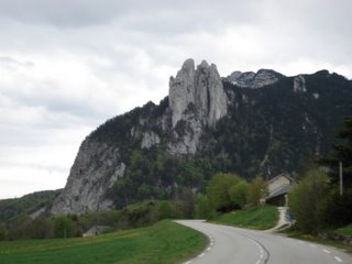
Looking up from St-Nizier

Looking east towards the Alps
As you might guess from the elevation profile, the ride to Villard-de-Lans was pretty easy going. After the long climb, this stretch of the ride is an alpine valley, with lots of agricultural land & settlements. Right after I started descending at St-Nizier, I got passed by a red Corvette & thought that was an unusual vehicle to see in France. I looked up again and realized it had California plates.
All of the drivers I encountered were very polite -- not just the guys in the beat-up citroen with the mountain bikes on the back but truck drivers, motorcyclists, yuppies in town, etc. Once I got up onto the Vercors massif, I started seeing lots of cyclists, individuals and groups...maybe they knew something I didn't because all but two of them were going in the opposite direction from me.
In Lans-en-Vercors I stopped and made my 1st search for water--there were some public bathrooms but they didn't have a sink, so I ended up filling my bottle from the water in the toilet tank. Haha. Just to see if you were paying attention...actually I found a tap in Villard-de-Lans.
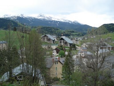
Looking S from Lans-en-Vercors with the east ridge of Vercors

Looking W from the same spot
In every one of the villages in Vercors there were signs for "Ski de Fond" (x-c skiing) and one for a "Domaine Skiable" which sounded interesting...I looked in the back window of a bike/ski rental place in Lans-en-Vercors and there was a big rack of several generations of Salomon x-c ski boots hanging on the wall. My favorite ski sign was the (sadly unlit) neon nordic skier suspended in the air as part of the welcome sign to Villard-de-Lans. (5/13: I later found out that Autrans, at the northern end of the loop on the Vercors in this ride, was the base for the x-c ski races in the 1968 Winter Olympics).
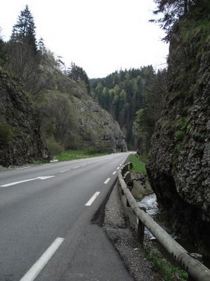
After leaving Villard-de-Lans I entered the first gorge--the road runs along a stream, with steep limestone walls on either side, before dropping into another alpine valley. I got a bit nervous here b/c it started to drizzle a bit--I had brought clothes for "partly cloudy" based on what I saw on weather underground earlier in the week--but it stopped soon enough. Overall the weather was perfect for riding--around 62-65 F I'd guess, without too much bright sunshine.
Up the gorge.
Down the gorge...
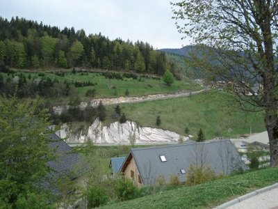
After Autrans began the second climb, which wasn't really much -- I had forgotten the elevation profile but this was only about 300m -- like the climb up Spruce to the intersection of Wildcat Canyon and Grizzly Peak in Berkeley that I often add on at the end of a ride for a little extra.
At the top...hardly worth a photo but I was stopped...

The descent on the D531 was great. The roads are wide and the curves are made for cars going 50 mph so there's plenty of room. Braking was hardly necessary & you could hold your speed through the turns. Even the few turns marked with warning signs were much wider than most of the turns on the climbs in the Bay Area. Great fun, & didn't feel dangerous at all. The descent started with another gorge then opened up with a panoramic view of the Chartreuse massif to the N and Grenoble to the E-SE with the Alps in the background.


At the bottom, I found my way through some residential and light industrial blocks on some bike trails to a trail that runs along the Isère River all the way back to Grenoble. A nice place for an easy spin for 20 minutes or so at the end of the ride.
Tomorrow...the Chartreuse.
posted by Derick at 5:00 AM
![]()

<< Home